Interactive Map
Display Marine Protected Areas, key marine habitats related data and information on online interactive maps.
MPA Database
Collate the best information on Marine Protected Areas for all Coral Triangle countries.
Search & Download
Search and download for datasets relevant to Marine Protected Areas and marine resources in Coral Triangle countries.
Countries
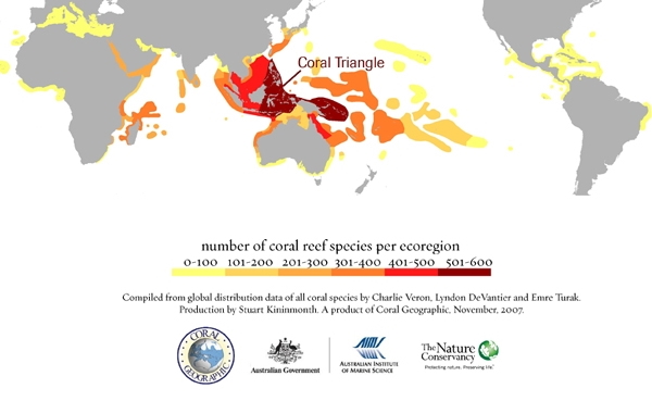
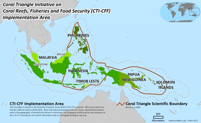
The Coral Triangle is an area encompassing almost 4 million square miles of ocean and coastal waters in Southeast Asia and the Pacific surrounding Indonesia, Malaysia, Papua New Guinea, the Philippines, Timor Leste, and the Solomon Islands. On May 15, 2009, the leaders of the six Coral Triangle countries met for a summit in Manado, Indonesia and signed the declaration launching the Coral Triangle Initiative (CTI) and endorsed its Regional Plan of Action. This event marked the culmination of a process launched by Indonesian President Yudhoyono in 2007 and supported by the United States to bring the six countries together to preserve the threatened marine, coastal, and small island ecosystems of the Coral Triangle region.
Datasets
Dataset by themes
Databases
Number of records in the databases.
